|
GUIDES & MAPS
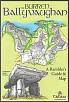
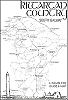
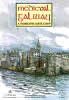
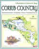
Tír Eolas has published seven Rambler's
Guides and Maps, covering the Burren, South Galway, Kinvara, Medieval
Galway and Loch Corrib. They give detailed information on the archaeological
and historical sites, the birds, animals and flowers to be seen
and the natural features found in the area covered by each map.
They are ideal aids to the discovery and exploration of the Burren
and Co. Galway.
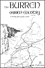
The Burren Series of Ramblers Guides
and Maps
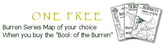
The Book of the Burren is full of information
covered by the
Burren Guides & Maps.
To go directly to the "Book of the Burren" click
here
These guides and maps are for the explorer, for the visitor who
wants to get
off the beaten track. For the person who wants to find a holy well
or ruined church shown on the map and make it his or her own discovery.
For
someone who has left the car or bicycle by the roadside and walks
up the
hill to seek out a ringfort or prehistoric tomb. You will need plenty
of time, at least a morning or afternoon, something to eat and drink
in your
backpack and a good pair of boots or walking shoes.
You may be a newcomer to the West of Ireland, as we were when we
set out to explore the Burren and South Galway from 1985 onwards,
and we invite you to retrace our footsteps. We being Jeff O'Connell
and myself, Anne Korff. I came to Ireland from Berlin in 1977 and
Jeff came from Chicago in 1967. We have both been living in Kinvara,
Co. Galway for more than twenty years.
Our reasons for exploring the area were curiosity and the desire
for
adventure, together with a wish to enrich our understanding of our
local
environment. I saw things through the eyes of a painter and artist,
Jeff as
a writer and historian. We complemented each other well.
Our guides and maps were accomplished by going out walking one day
a week, whatever the weather, in the winters of 1985 to 1990. We
used as base-maps the six inch to one mile maps of the Irish Ordnance
Survey and the sketch-maps of Thomas J. Westropp (1860-1922). This
remarkable gentleman had surveyed, described and illustrated all
the archaeological remains and historic monuments of the Burren
and North County Clare. It was exciting to follow his directions
and sketches and a real joy to find a certain monument we had set
out to discover. Often the sites were little changed but sometimes
we were disappointed to find only a cleared field.
I would photograph what we found, with a view to make pen and ink
drawings at home. Jeff would check the site against Westropp's notes
and other archaeological and historical sources. Those days of rambling
through the Burren were great fun and both of us still regard them
as a high point of our lives. The guide part was written by Jeff,
compressing all the
information he had gathered into seven pages of text. I drew the
maps and
the illustrations, with the place-names and names of the archaeological
and
historic sites compiled by Jeff.
We hope the enthusiastic rambler will share our joy and sense of
enrichment in exploring this unique landscape.
Anne Korff
Doorus, Kinvara
|
|
|
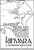
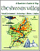
JUST PUBLISHED!
The SHANNON VALLEY - A Rambler's Guide and Map
The SHANNON VALLEY covers the area in the triangle of land between
Athlone, Ballinasloe and Portumna and centres on the River Shannon,
River Suck and Little Brosna River...
A1 map: Euro 8.00
READ MORE | BUY
THIS MAP | BACK TO TOP |
 |